We bet you didn’t even know that there is, correction – there are – alternatives to the Google Maps API. Once you’ve used Google Maps on your phone or computer chances are, next time you start typing ‘maps’ in the search bar, you are immediately directed to maps.google.com .

So it comes as no surprise that this is the number one choice for online maps. But be prepared to learn about all of the other alternatives to Google Maps that are better: better at mapping, better at navigating, and better for businesses.
Why you should be using one of these alternatives to Google Maps API
But wait – why bother even looking at a Google Maps API alternative? Just over a year ago, Google announced that they had mapped 10 million miles (16 million kilometers) of Street View imagery, which equates to 400 trips around the globe. Today nearly 2 million websites around the world use Google Maps API; Google Maps has 61.73% market share; in the US alone over 660,000 websites have embedded Google Maps; and Google Places is found on 146,125 websites.
So if so many sites, companies, and individuals use Google Maps, why look somewhere else? Well, contrary to popular belief, being the biggest on the market doesn’t guarantee you’re the best.
If you’re a business owner, the answer could be in the price. Having the Google Maps API installed on your site means that you are only allowed 28,000 free requests a month. For each subsequent request, it is $7 for every 1,000. However, it wasn’t always this way.
A bit of history for those out of the loop.
The epic controversy of the “Google Maps Price Hike”
Photo: R. Liberato
Way back in June of 2018, an infamous event occurred that shocked developers and left drastic changes (and fees) for those who use the Google Maps API. Moving from a choice of 2 plan fees (Standard and Premium), Google increased prices by more than 1400% in a single day!
Any project which utilized Google Maps would, at that point, be required to use a valid API key. Without the access key, keyless calls would render low-resolution maps with a watermark stating ‘for development purposes only.’
Before this extreme hike in pricing, businesses could spend about $200 per month and receive up to 25,000 free loads per day. After this ill-fated day, the same amount of money would get most businesses about 28,000 free loads per month!
To understand how quickly this can add up, take this civil hacker from Taiwan who learned the hard way that calls on the Google Maps API can mean big bucks in the blink of an eye.
A Taiwanese civic hacker named Howard Woo created an app during the 2020 COVID-19 pandemic that tracked where people could find masks in Taiwan. But each time someone used the app and ‘requested’ use of Google Maps, the free requests got used up and the charges quickly piled up.
In fact, within 2 days of launching the app 600,000 people had used it, well over the free limit and Howard was left with a bill worth $26,000 USD! (Google did eventually graciously drop the charges once it was aware of the use of the app.)
And even if you aren’t a business owner, there are lots of incredible features that Google Maps does not have. Have a look below at our list of alternatives to Google Maps and you’ll soon be on your way to better navigation.
And so began the hunt by developers, businesses, websites, and private citizens for an alternative to Google Maps, which would provide the solutions provided by mapping services.
12 Free Alternatives to Google Maps
1. Mapillary
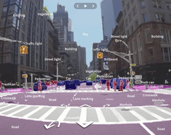
Mapillary has been coined by one map loving writer, the “darling of the mapping world.” Originally launched in 2013 with the goal to go toe-to-toe with Google Street View, Mapillary was able to map 3 million miles of streets by 2018 (only 5 years after launching), which puts it in the same playing field as Google, who as you remember had mapped 10 million, but launched in 2007 and has considerably more resources on their side.
Best in class:
- For those who want to challenge the norms (aka Google) and also assist in creating a map of the world.
Features:
- Three types of data from which to ‘subscribe’: imagery, object detection, map features
- Scales and automates mapping using collaboration, cameras, and computer vision
- Anyone can help create and maintain maps
- Use of face and license plate blur for added privacy
Price:
Better than Google Maps:
- It’s created by crowd-sourced contributors, and some of them are diehard believers
- Can be created with the use of smartphones and other cameras
- Images on the platform are licensed to anyone who needs them (and pays – but Google doesn’t even allow that)
2. Bing Maps
Bing Maps might be one of Google Maps largest competitors, as it is the second highest market share for a search engine (although 88% followed by 6% doesn’t quite seem like first and second places, so much as first and …….is there a second place?). The interface is similar to Google Maps but cleaner and leaner without losing any features. There are layers to the maps – road, aerial, and streetside – plus public transportation and walking maps for those without a car. And there are even 3D views.
Best in class:
- For those living in the UK (especially town planners), as it comes complete with full ordnance survey (OS) map of the United Kingdom
Features:
- A clean interface, easy to use and quickly see the navigation directions
- Multi-layered map with road, aerial, and street view layers
- Easily plan and print maps
- Add destinations along the route
- Ability to save places to your personal library
Price:
Better than Google Maps:
- cleaner, more modern interface which is easier to use
- ability to save places to your personal library
- Highly detailed map with multiple layers
3. MapQuest
MapQuest is just as old as both Bing and Google Maps, and similarly to Google Maps, it offers both a web-based tool in addition to a mobile app, allowing you to sync your directions between your phone and computer.
Best in class:
- For knowing how much you’ll burn in both fuel costs for driving or calories if your walking
Features:
- can detect IP address and give directions from your current location
- Detects traffic cameras, accidents, and construction sites
- accurate travel times with traffic levels, distances
- estimates fuel costs
- zoom controls, traffic or satellite views
- location finder (schools, hospitals, grocery stories, etc)
Price:
- FREE (however there are ads within the app)
Better than Google Maps:
- calculates fuel costs
- quickly make reservations for hotels with integrated tool
- one-button tool for finding specific shops or destinations
- re-routing planner is more user friendly
4. HERE WeGo
HERE WeGo is a mobile app that specializes in offering various forms of transportation from subway/metro/subway to bus, bike, train, trolley or ferry. It plans your road trip out to the very end, including where you can park when you arrive (which is sometimes the most time-consuming and frustrating task of all when driving). Another fun fact, HERE is owned by an A-list group of car brands, including Audi, BMW and Daimler.
Best in class:
- For simple, easy to understand interface, no distractions, and maps are updated daily
Features:
- Offers public transit information for 1300+ cities
- Online and offline maps for over 200 countries
- Allows you to see the cost for public transit tickets and cab fares
- Recommends several modes of transit in order to get to your destination
- Deletes timestamps used in navigation once you’re finished using the app
Price:
- FREE for 250,000 requests monthly, $1 for each subsequent 1,000 OR $449 for 1,000,000 requests monthly
Better than Google Maps:
- It’s much faster at plotting a route and starting navigating
- There are fewer distractions while in navigation mode
- The mobile interface is larger, making it easier to understand at a quick glance, crucial while on the road
5. TomTom
TomTom is a bit different from most of the maps on this list because it has a very short lifespan in which it is free. The mobile app is only free for the first 30 days. After that there is a nominal fee of less than $2 per month (which decreases the longer subscription you register for. This is totally made up for by the fact that you are guaranteed to have an ad-free ride, with no worries about having ads pop up during your journey.
Best in class:
- For those of us who forget the name of that place we found randomly last summer but have documented it all with photos
Features:
- Weekly map updates
- Moving lane guidance so you know what lane is yours for junctions and exits
- Speed camera warnings
- Share your ETA (estimated time of arrival) with friends and family via the messaging platform of your choice.
- ‘Drive to Photo’ which allows you to set a destination based on any geotagged photos you’ve taken
Price:
- FREE for 30 days and then subscriptions for
- $1.99 – 1 month
- $8.99 – 6 months
- $12.99 – 12 months
Better than Google Maps:
- Superb satellite navigation
- Search by location, see traffic density
- Maps are updated weekly
- Traffic and speed camera detection is uUpdated in real-time
6. Rand McNally
Rand McNally is the only map on this list which was once a real live, physical map, made of paper, which you could hold in your hand, fold the wrong way, and store in your glove compartment. In the wake of the digital age, the publishing giant rolled with the times and moved to online maps and they don’t disappoint.
Best in class:
- For professional drivers such as long-haul truckers, offering business tools and technology that connect to their driving platform
Features:
- Simple online interface
- Highly-detailed maps, showing even the most minute map features
- Ability to see the contours of the land
Price:
Better than Google Maps:
- Considered one of the most highly-detailed mapping services
- Can save locations to your personal library
- Zooming is quick and simple
- Satellite views are superior to other services
7. Maps.me
Maps.me initially forewent the web version and went directly to the mobile app version of their maps (they have since created a web version). They offer some of the best offline maps, with an easy to navigate interface and unlimited number of maps for downloading, covering nearly every square yard (or meter) of the world. It’s surprising how accurately they can get, even finding small footpaths through fields in obscure locations.
Best in class:
- For travelers because it’s free and doesn’t use up data (if downloaded while on WIFI ahead of time)
Features:
- Completely offline (once you’ve downloaded the map)
- Requires very little memory on your phone
- Auto-follow mode
- Save and send maps to friends
Price:
- FREE, only download the map for your current location or where you are traveling to while connected to data and then you are free to use
Better than Google Maps:
- Offers complete, easy to navigate offline maps
- It doesn’t require a lot of memory space for offline maps
- Able to download free travel guides for your next destination
- Includes traffic and subway layers not included in most other online maps
8. OpenStreetMap and OsmAnd
OpenStreetMap (OSM) and OsmAnd are home-grown as they say, built by sourcing data from its community of over 2 million users from around the world. OSM is the platform for the collaboration of the mapping information which is displayed on the OsmAnd app. If in your far-flung travels, or simply driving the kids to football practice and you want to edit or add some feature to a map, you only have to register and you can assist in the creation process.
Best in class:
- The best and most accurate FREE mapping tool available
Features:
- Shows icons for local businesses
- Is downloadable and allows for offline usage
- Incredible details such as the direction of river flow
- Multiple layers within the map
- Extremely accurate route planning the whole journey
Price:
- The website is FREE to use, the mobile app is free at first but only allows for 7 free map downloads for specific locations before you have to upgrade to the premium version ($1.99 / month)
Better than Google Maps:
- Has aided in humanitarian aid (such as the 2010 Haiti earthquake)
- Has assisted in scientific research
- Uses no mobile data (once downloaded)
- Works without an internet connection
- Considered one of the most detailed maps available
9. Apple Maps
As we all know, Apple loves to make everything its own, and that goes for this Apple Maps app. The company particularly focused on creating a mapping service which allows users the most amount of anonymity as possible. Within 24 hours of broadcasting your exact location, the app blurs that location so that you are granted privacy. In addition, any saved locations are encrypted end-to-end so that Apple can’t access them.
Best in class:
- For privacy, Apple has done the most to ensure its users have the most secure mapping experience possible
Features:
- Ability to see recent places you’ve been
- Pulls information from Yelp
- Does not link data to your Apple ID
- You can see elevation, busy streets, stairs, and steep passages
Price:
Better than Google Maps:
- Privacy, hands down much more privacy is offered through Apple Maps
- Avoid hills during a workout or go for them!
- Includes information from Yelp Business
- Great in-app guide for eating, shopping and exploring
- Find your parked car and get directions to it.
- See real-time updates for your flight information within the app
10. Waze
Waze was created to be a mobile app, so much so that the web version doesn’t even look like a navigation tool at first. The app lets you easily choose your destination and add other locations on the map to edit your ride. Since other Wazers can enhance their rides by adding real-time information such as accidents, speed checks, and traffic, it makes for a more social experience.
Best in class:
- To quickly change plans in the middle of a route
Features:
- Fun, interactive tool with social interaction
- Enables future road closures and real-time traffic updates
- Specialized routes for motorcycles users
- Specialized routes for those eligible to drive in carpool (carshare) lanes
Price:
Better than Google Maps:
- able to integrate with your music
- more sociable driving experience
- better real-time updates on speed traps and crashes
- interact with your fellow drivers
11. Pocket Earth
As it suggests, Pocket Earth maps allows the user to carry a little bit of the earth in their pocket, acting as both an offline map as well as a travel guide. It is for iOS-only and utilizes OpenStreetMap, providing users with the most up-to-date information to help navigate you to your next destination. It also allows users to download maps ahead of time and use them offline.
Best in class:
- For hikers and those setting out to explore, thanks to the Wikipedia layer, as well as the topographic map option
Features:
- Voice navigation
- Multi-layered, including Wikipedia, linking the map to points of interest
- Enables you to create categories from your favorite locations to suit you and your lifestyle
- Specializes in backpacking and hiking trails and routes
Price:
- FREE (but only on iOS), about $6 or 6£ for the pro version and another $5 or so for the topographic maps
Better than Google Maps:
- Uses OpenStreetMap which has more up-to-date data
- Great in-app tools such as pins, which allow the user to categorize their locations
12. Citymapper
Citymapper specializes in….you guessed it – cities! The web version, as well as the Android and iPhone versions all specialize in providing the most accurate and precise navigational directions within cities. While some maps, including Google Maps often miss certain forms of public transit while giving your options, Citymapper has them all. Everything from the BART in San Francisco to the S-Bahn in Berlin are properly documented on the app, ensuring you don’t miss the last train or metro home.
Best in class:
- For city dwellers and those visiting the city, hands down the best map for your city
Features:
- Finds you the ‘best quiet’ routes
- Gives you parking directions for the end of your trip
- Includes e-bikes and scooters as part of the transit system
- The most enthusiastic fan-base for any mapping system we’ve ever seen (not sure if it’s a feature, but had to mention)
Price:
Better than Google Maps:
- Much more comprehensive information regarding city transport
- Included eco-friendly modes of transportation
- Contains a ‘Get Me Home’ button to get you home faster
So, there you have it – 12 maps, which as their mothers would say, ‘is unique and special in its own way.’ Whether you’re looking for a more simplified, clean interface or a more detailed map, or one that is better for hiking or for cities, there is a map out there that can satisfy your needs.
Go ahead, be a rebel – choose something other than Google Maps. You’ll be happy you did so.
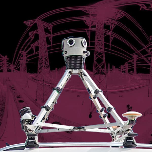
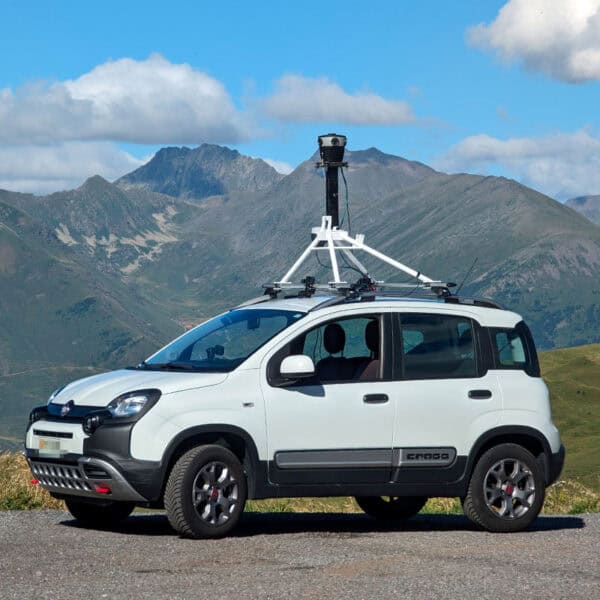
You can learn more about the technology which is assisting mapping services to build these incredibly detailed diagrams of our world by checking out some of the best surveying cameras for mobile mapping.

