Smart city technologies have proven to be a game-changer for redeveloping and planning cities!
This article was updated in March 2025.
What smart city technologies are currently at play?
Thanks to numerous smart city technologies and solutions, city planners are innovatively transforming urban environments. Technology-driven cities work in conjunction with various digital prospects, such as smart city lighting systems, IoT devices, traffic and transportation management systems, mobile mapping services, and more.
However, with so many technological options, which are ideal for developing a smart city?
Follow along as we evaluate some of the smart city solutions for a futuristic world!
What is a smart city?
A smart city is a technologically modern urban area that uses different types of electronic automation concepts, digital devices, sensors, and voice activation methods to collect real-time data. According to the European Commission,
A smart city is a place where traditional networks and services are made more efficient with the use of digital solutions for the benefit of its inhabitants and business.
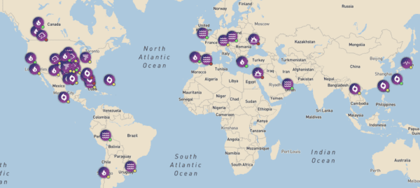
Note: Smart City IoT active connections in European Union 2016, 2019, 2022, and 2025 in millions.
Urbanization has played a vital role in transforming cities towards innovation. With constant evolution, many cities are finding success by converting their archaic operations to smarter workflows!
So, let’s move further and get in-depth know-how on the current technology trends essential for smart development.
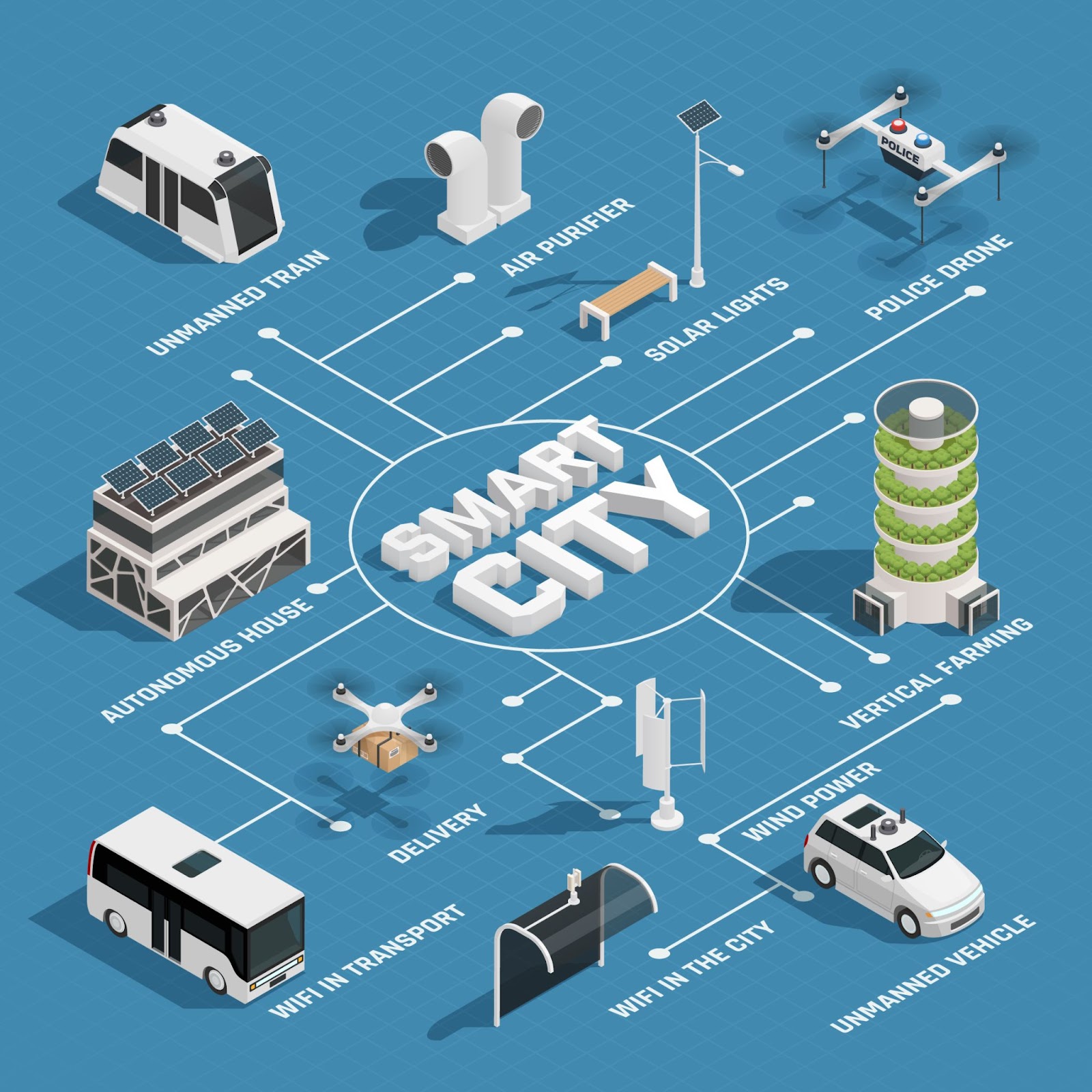
The five best technologies for creating smart cities
In a smart city, technology varies from different regions, areas of operations, and administration. Hence, it is very important to use technology according to the needs and necessities of the city. The five best technologies are:
1) The Internet of Things in infrastructure
What is IoT? Oracle defines IoT as:
the network of physical objects—“things”—that are embedded with sensors, software, and other technologies for the purpose of connecting and exchanging data with other devices and systems over the internet.
This is evident in many facets of our lives, both personal and professional. In infrastructure, this means introducing multiple intelligent solutions, such as sensors installed in buildings that can monitor the health or condition of infrastructure, elevators in residential or commercial spaces, and more. The introduction of IoT devices to modern cities has proven to be efficient.
How?
It provides real-time data and repair and maintenance alerts. These features make it easy to predict and effectively prevent long downtime.
Waste management in conjunction with the Internet of Things is a great technique for a smart city. Every city has certain necessary rituals, and one of the most critical is waste management. If waste is managed precisely, numerous points of friction can be addressed, like meeting environmental obligations and better recycling prospects. Necessity is the mother of invention!
A smart city waste management system involves placing sensors in waste containers and continuously monitoring the trash level of the garbage cans. Based on the data from the sensors, the ideal garbage truck route is designed, taking into consideration only the filled garbage cans. This eliminates the need for vehicles to stop at every garbage can, only those that need to be emptied.
2) Digital twins for smart cities
What is a digital twin?
A digital twin is a replica in the digital world of a physical location or thing. Thanks to artificial intelligence and machine learning technologies, digital twins are 3D digital models engineers can swiftly update to reflect changes with their physical counterparts.
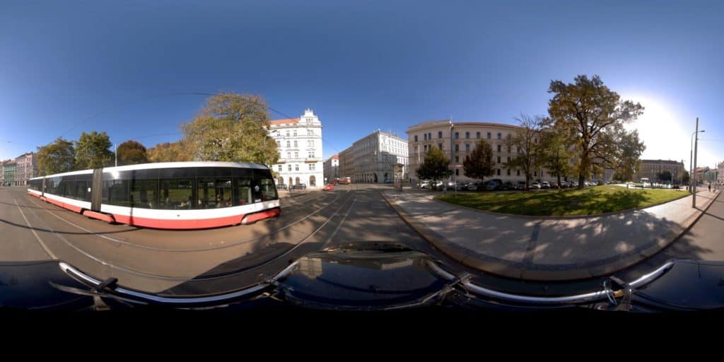
To create an accurate digital twin of a city, you need to capture accurate and high-resolution street-level image data to display it properly in its truest form.
Check out more about Digital Twins here.
Mosaic’s range of 360-degree cameras has proven efficient in capturing such accurate and high-resolution imagery. The Mosaic X and Mosaic Viking’s abilities to collect the necessary data at much faster rates than other solutions and at much better image quality means that users can improve decision-making processes. These include reporting road and infrastructure conditions for management and maintenance.
The range of Mosaic’s cameras with cutting-edge techniques enabling 3D reconstruction and asset modeling is shown below with this 3D model of Prague, a European capital that is incorporating smart city technology.
The best cameras for digital twin technology
The Mosaic X: Meet the only 360-degree mobile mapping camera featuring a global shutter for photogrammetry ability at highway speeds. This camera is designed for capturing faster and better data the first time. Drive at highway or city speeds to collect the data you need for high-resolution 360-degree maps and 3D models. The Mosaic X is a self-contained, single-manned device that requires little to no training. Make better use of your workforce to save time and money!
It is also cost-effective, allowing you to expand your fleet and take on more projects and customers.
The Mosaic Xplor: Cities aren’t for cars, they’re for people, and your data should reflect that. Thanks to the Mosaic Xplor, narrow alleys, pedestrian zones, building interiors, and parks are finally accessible for digital twin technology. Take the high-resolution and durability of our other Mosaic products, now in portable form!

The Mosaic Viking: Let’s welcome the world’s highest-resolution 360-degree camera, the Mosaic Viking. It offers the finest capturing experience with 20K resolution that captures every bit of detail! A single pass with the Mosaic Viking at high speeds is enough to generate a 20K resolution 3D model. Only the highest-quality camera, with 180MP crystal-clear results, can offer the highest-quality images.
3) Geospatial technologies for smart cities
Another one of the more innovative smart city technologies is geospatial technology, which refers to an assortment of modern tools that contribute to the geographic mapping and analysis of the Earth and human societies. Examples include cameras, aerial cameras, drones, satellites, and more.
City planners and engineers use these technologies in smart cities to better understand urban settings. They see available space and ponder how to utilize the city’s resources better, as well as to predict how current roads and buildings might fare in disasters. These technologies respond to citizens’ requirements by providing solutions for water, transportation, power stations, network supply, and public services.
Benefits of Geospatial tech include:
- Improving decision-making by solving difficult tasks,
- Contributing to data transparency for citizen access,
- Improving communication for better crisis management,
- Aiding in the management of natural resources, and
- Aiding in the government’s decision-making.
With new technologies entering the market, mobile mapping has made gathering geospatial information at street level a lot easier. For infrastructure maintenance and visual assessment, Mosaic’s mobile mapping cameras are the highest-resolution 360-degree cameras specifically for street mapping.
And with the Mosaic 51, it has become even simpler. It is an ideal camera with ultra-precise GPS for high precision.
The Mosaic 51 is a durable 12K-resolution 360-degree camera designed specifically for HD mobile surveying, GIS, railway, and infrastructure inspection. The all-in-one solution can withstand extreme cold, heat, precipitation, snow, and mud. It’s built for the road, regardless of terrain or climate, with a built-in computer.
This camera is built for rugged, outdoor data capture. It’s waterproof, dustproof, and watertight. Its industrial frame, IP64 rating, and changeable lenses allow it to operate all day without needing to reboot, recharge, or download data.
4) Smart street cameras
Smart street cameras have different features that are also useful in developing smart cities. Sensor cameras have become one of the promising technological innovations for a smart city. They can be used as connected street cameras, vehicle dashcams, and first responder bodycams to investigate the root cause of street-level issues.
Smart cameras are not only used to identify street crimes but also for maintenance purposes. By identifying potholes, cracked roads, and inaccurate street markings, smart cameras can be considered the explorers of street accuracy and a great benefit for turning a city into a smart city.
Benefits of smart street cameras
If we want to live in a safer city, we must welcome newly emerging technologies. Smart street cameras are not only a step toward a smart city, they also give visitors and residents a secure feeling to work, travel, and live.
Constant monitoring of movements and activities
Smart street surveillance cameras offer high-definition video footage, allowing security authorities to efficiently and safely monitor the city.
Nowadays, smart street cameras enable photo transmission securely over the network to prevent spoofing and unwanted access to sensitive data. Authorities may cover every inch of the city, including footpaths, parks, roadways, and other high-traffic areas, with high-performing devices positioned close together to offer better protection.
Monitor vehicle surveillance
Vehicle monitoring is also important for a city’s development. Whether it’s a public or private vehicle, they have a tendency to break and exploit certain major restrictions. As a result, it’s critical to keep a close eye on what’s going on inside and outside of the car. If something goes wrong, it will be easy to see, and the matter may be handled before it gets out of hand.
Smart street technology can also recognize the number plates of vehicles attempting to breach the traffic signals, overtake other vehicles, or steal. This will make it easier for traffic cops to identify and prosecute offenders accurately.
5) Open data vault
Last but not least on the list of smart city technologies is the open data vault. Governments, businesses, and individuals have traditionally kept their data close, sharing as little as possible with others. Open data is reshaping the digital city today. The perceived usefulness of sharing information has far overcome privacy concerns and security failures in many departments.
However, all players in the complex ecosystem share information and combine it with contextual data assessed in real time, which is crucial for facilitating sustainable smart cities.
This is how real-time, well-informed decisions are made. By analyzing real-time contextual information provided among sector-specific information and operational technology (OT) systems, many sectors must collaborate to produce superior, long-term results.
Technology, digitalization, and innovation represent the backbone of smart cities in our fast-paced, modern world. When it comes to using top-notch smart city technologies to move towards a more connected smart city, you can count on Mosaic as the best-in-class for data capture and geospatial imagery!
For more information on how to make your city into a smart city with new technology, visit our website or contact us!