Lessons learned – why choosing the right device is crucial
The Orlando Downtown Development Board (ODDB) is dedicated to the revitalization and enhancement of Orlando’s downtown area. Their main goal is to attract outside investment by showcasing the city’s progress in infrastructure, public transit, and beautification efforts.
Key earnings for Mosaic’s customer:
- Reduce data capture from 2 weeks to 3 days.
- Need to recapture was eliminated as the camera reliably captured all required imagery with accurate GNSS data, even in urban canyons and without corrupting data.
- Higher resolution images made for a happier, more satisfied end user of the imagery collected by the Mosaic 51 camera system.
Challenges Faced Before Using Mosaic 51 Camera System
Before adopting the Mosaic 51 camera system, Mosaic’s customer faced significant challenges in accurately and efficiently capturing high-quality street view imagery. Their initial attempt using the NCTech iStar Pulsar, a well-known 360 camera, was unsuccessful, leading to subpar results that were not accepted by the customer, and ultimately, they were not compensated for the effort.
Implementation of the Mosaic 51 Camera System
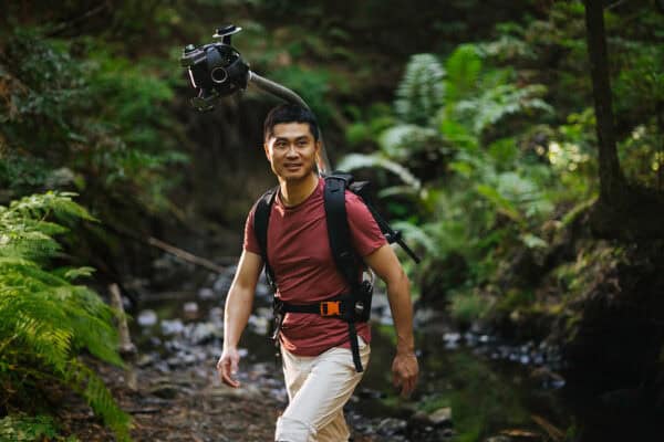
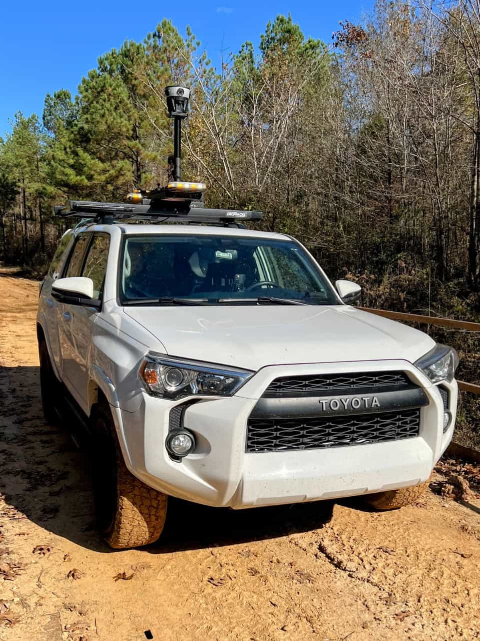
The decision to switch to the Mosaic 51 camera system was driven by the need for reliable, high-quality imagery that could be used to attract investment. The Mosaic 51 camera system was integrated into their workflow with minimal training, thanks to its user-friendly interface and robust support from Mosaic’s customer’s team.
Project Execution
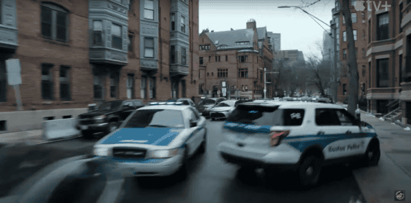
The ODDB engaged Mosaic’s customer to capture street view imagery using the Mosaic 51 camera system. The designated area included various neighborhoods and business districts in downtown Orlando, with specific focus on the Camping World Stadium and intersecting highways.
The project involved capturing approximately 160 gigabytes of panoramic images at a spacing of around five meters. Despite challenging weather conditions, the project was completed in about a day and a half. The captured imagery was then published on platforms like Mapillary and Google Street View, providing a current and comprehensive visual overview of the area.
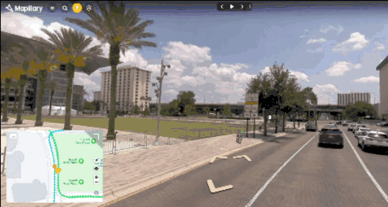
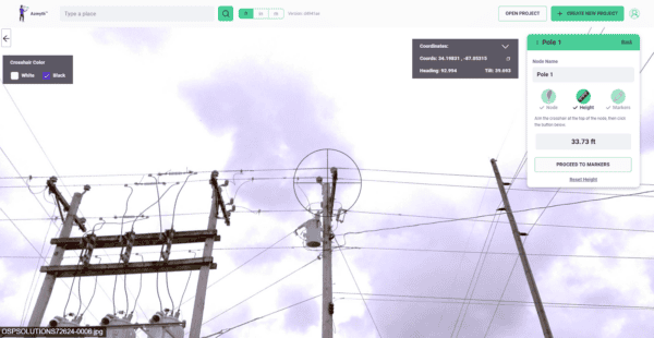
Follow the link above to see imagery captured and shared on Mapillary specifically for this project. This first pano is from between City Hall and the Performing Arts Center in Orlando.
This project highlights a fascinating use case aimed at clearly representing the area to attract further investment. Some of the recorded areas were still in need of an economic boost or beautification, which could be supported by community redevelopment grants. The idea is that by enhancing and making areas more accessible and attractive, they are more likely to draw investment, whether from outside or within Orlando and Florida. This investment could support new businesses, large development projects, hotels, and restaurants, further advancing the ongoing progress in the downtown area.
Usage and Applications
The Mosaic 51 camera system has been used by this customer in particular for various projects, including urban planning, infrastructure maintenance, and GIS. In this particular project, the system allowed for efficient collection of 360-degree street view imagery, which was instrumental in showcasing the city’s development to potential investors.
Benefits and Outcomes
The use of the Mosaic 51 camera system brought several benefits:
1. Time Savings: The system significantly reduced the time required for data capture and processing, allowing the project to be completed swiftly despite initial delays. For example, previously using a different camera system the project took well over two weeks to complete, not including processing time and uploading through the cameras proprietary processing channel. Whereas with the Mosaic system, the project took a total of 3 days to drive to the site, capture the imagery, process the captures, and upload it to the requested online platforms.
2. Reliability: The data collected proved to be highly reliable for repeated use, ensuring consistency and accuracy in visual representation. The camera reliably captured all required imagery with accurate GNSS data, even in urban canyons. As well, there were no collections that were corrupted and needed to be recaptured. Lastly, time on location was reduced due to reliability of the Mosaic system as there were no instances of the camera not functioning properly (disconnections which stopped captures in progress, no delays in acquiring GNSS fix or general power on issues which required waiting for the camera to power cycle multiple times in order to begin working properly again, and the removable SSD in the Mosaic meant that there were no issues transferring the data to a processing workstation whereas with the previous camera it was necessary to use another storage device to transfer the captures from the camera to and external SSD, and then to the processing workstation.
3. Quality Improvement: Compared to the previous attempt with an NCTech camera, the Mosaic 51 provided superior image quality that met the client’s standards and requirements.
Value Addition
The high-quality imagery captured by the Mosaic 51 camera system added substantial value to ODDB’s efforts. The visual data helped to clearly represent areas in need of investment and beautification, thus making them more attractive to potential investors. This, in turn, supported the broader goals of community redevelopment and economic growth.
Feedback and Future Use
The feedback from stakeholders has been overwhelmingly positive, with praise for the clarity and detail of the imagery. Looking forward, the local development board can showcase Orlando’s development to all interested parties.

Initial Q & A with Mosaic customer:
How did the camera make your job easier?
The Mosaic camera significantly simplified our work due to its reliable GNSS signal. Unlike previous cameras that were labor-intensive and often misplaced images—placing them in the middle of buildings instead of on the roads—the Mosaic camera’s accuracy, especially in urban areas with high buildings, improved the placement of images. Additionally, previous cameras involved extensive processing time and frequently corrupted captures, necessitating repeated visits to sites. These issues combined to deliver a subpar product to our client, often behind schedule.
Why was your first project unsuccessful?
The issues outlined above regarding the reliability of the camera and data processing complications led to the initial project’s failure (pre-Mosaic). These technical difficulties prevented us from delivering a quality product on time, directly affecting the project’s success.
Can you give examples of how the data was being used?
The data served multiple purposes, primarily aimed at attracting outside investment and showcasing the progress in local development. Examples include:
1. Documenting urban redevelopment and the impact of external investments on building new businesses.
2. Supporting initiatives like tax incentives designed to encourage businesses to enhance the appearance of their buildings.
3. Providing visual documentation for use in virtual meetings and presentations to display the current state of the area to potential investors and stakeholders.
This approach is not unique to our project; it mirrors common practices seen in places like the Gainesville Community Redevelopment Agency.
Conclusion
The Orlando Downtown Development Board’s project, with the use of the Mosaic 51 camera system, is a testament to the importance of choosing the right technology for the job. The switch from the NCTech iStar Pulsar camera to the Mosaic 51 camera system resulted in superior outcomes, demonstrating the value and reliability of this system in urban development and planning initiatives.