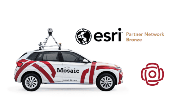
Mosaic, a leading provider of high-end terrestrial imagery hardware, is excited to announce a strategic partnership with ESRI, the global market leader in geographic information system (GIS) software, to support and enhance ESRI’s ArcGIS platform with Mosaic’s cutting-edge 360° imagery technology.
Enhancing ArcGIS with Cutting-Edge 360° Imagery
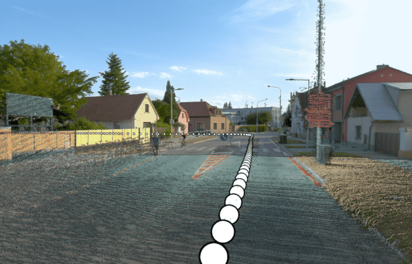
Mosaic’s partnership with ESRI brings industry-leading 360° imagery to the forefront of geospatial data visualization within the ArcGIS platform, specifically enhancing the Oriented Imagery visualization tool. This collaboration allows Mosaic’s camera imagery to support ESRI’s powerful GIS software, benefiting customers of both companies.
“By utilizing Oriented Imagery within ArcGIS, users can manage, visualize, and explore diverse image collections in a map context, providing unparalleled detail and immersion. This significantly advances spatial analysis, situational awareness, and decision-making support.
Mosaic customers will be able to visualize their imagery using the best GIS software solution available, while ESRI customers will benefit from the superior visualization capabilities offered by Mosaic’s high-resolution imagery”,
states Dylan Faraone, Regional Director at Mosaic.
Advancing Geospatial Data Visualization Together
This partnership marks a significant step forward in providing customers with enhanced tools for geospatial data visualization and analysis. Stay tuned for more updates as both partners continue to develop and deploy their integrated solutions.
Arkadiusz Szadkowski, leading Global Business Development & Sales for Reality Mapping at Esri, comments:
“I’m glad to see this new partnership with Mosaic happening. Integrating their robust 360 imagery technology into our GIS platform presents incredible opportunities for theirs and our users. I see a huge value proposition in the combination of 360 imagery with GIS, especially 3D GIS and Reality Mapping. That brings a new level of detail and immersion to spatial analysis and visualization.
Esri’s capabilities in oriented imagery, along with our platform’s flexibility to integrate external widgets, make it possible to leverage Mosaic’s innovative solutions effectively.
I’m especially a fan of Mosaic Viking, the highest panoramic camera available on the market, which exemplifies their commitment to excellence and innovation.”
Pam Blackmore, GIS/GPS Specialist, emphasized the benefits of using Mosaic and Esri, stating:
“I compared four cameras for our county. On every single metric, the Mosaic 51 beat out its competitors: its image quality is best, it came with a powerful script to stitch the imagery together and save us enormous amounts of processing time, and the imagery is nonproprietary so it comes in seamlessly to our ESRI software.”
Mosaic will be attending the Esri User Conference, the world’s largest GIS conference, from July 15–19, 2024, in San Diego, California. The partnership comes at an opportune time, as the Esri UC falls in just 2 weeks. This event presents a unique opportunity to discover how the latest advanced solutions elevate the geospatial world.
Learn how to maximize GIS potential with 360º imagery by Mosaic cameras and Mapillary integration in ArcGIS Pro on our YouTube channel:
UPDATE: Check out this latest video with Instant App Builder:
Interesting in learning more about Mosaic’s line of mobile mapping camera systems? Fill out the contact form below or write to us at sales@mosaic51.com