Shaping the Future in South America Together
Update February 2025: Read our follow-up article with ARX after they performed high-resolution cadastral mapping and surveying using the Mosaic 51.
Mosaic, a leader in 360° mapping camera technology, is excited to announce its strategic partnership with Brazilian geospatial company ARX. This marks a significant step in its efforts to expand its footprint in South American mapping and surveying market. The collaboration brings Mosaic’s pioneering technology to the forefront of the Brazilian market. Mosaic and ARX offer unprecedented precision and practicality in urban mapping and surveying applications.

Innovative Technology Meets Local Expertise in Mapping and Surveying
Mosaic’s premier product, the Mosaic 51 camera, is designed to meet the rigorous requirements of urban mapping and surveying. It uniquely suits Brazil’s diverse landscape and delivers exceptional data quality in both rugged and urban environments.
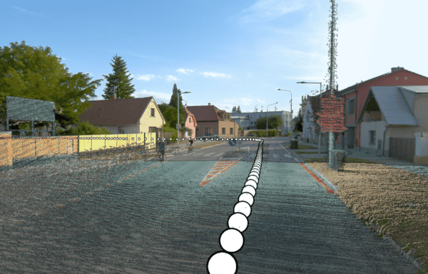
This partnership harnesses ARX’s vast local knowledge and expertise, maximizing the application of Mosaic’s cutting-edge technology in Brazil. A key success of this collaboration is integrating the Mosaic 51 with a high-resolution IMU/GNSS system. Thus, creating a mobile mapping system that marries high-definition LiDAR, 360° digital imaging, and sophisticated GNSS/IMU positioning technologies.
This integration supports various applications, from asset registration on highways and railways to urban registry and tree mapping. These combined technologies showcase adaptability and efficacy in the cadastral mapping industry.
ARX: Pioneering the Brazilian Geospatial Industry
ARX introduces an innovative Portable Land Mobile Mapping System, celebrated for its high resolution and versatility in mapping capabilities. This system, integrating a high-definition LiDAR system, a 360° digital camera, and a GNSS/IMU positioning and guidance system, propels ARX to the forefront of the field.
It’s designed to facilitate various applications such as registering assets on highways and railways, planimetric surveys for executive projects, tree mapping, urban registry with automatic geocoding of facade photos, urban accessibility analysis, and the inventory of vertical and horizontal signage, among others.
The collaboration between Mosaic and ARX will redefine the geospatial industry in Brazil, heralding a new era of precision and efficiency in mapping and surveying projects. This cooperation not only underscores Mosaic’s commitment to advancing geospatial technology but also illustrates the synergy between global innovation and local expertise.
“With the partnership with Mosaic, we are bringing high-resolution and quality cameras to the Brazilian market to integrate our systems, which are aimed at urban, road and railway registration applications.
Due to the superior resolution of 12 megapixels, Mosaic cameras enable the identification of registration information with greater quality and clarity when compared to traditional systems with 5-megapixel cameras.
This way, our customers will be able to generate products with greater precision, completeness of information and image quality. Our team is prepared to offer all the necessary support to customers, ensuring the success of this initiative.”
Roberto Ruy, Director of Sales, ARX
ARX, based in São Paulo, Brazil, leads in providing cutting-edge geospatial solutions. With a focus on mobile mapping and surveying technologies, ARX is pioneering new methodologies in the geospatial sector.