Gain access to 15 terapixels of street-view data of Prague for research and testing, all for free!
Our gift to the research community
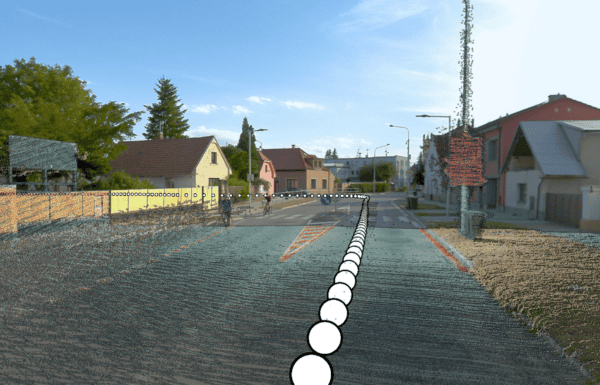
After years of circling Prague and capturing high-resolution imagery of nearly every street, dead end, alleyway, and boulevard in the downtown area, we realized we had a very valuable dataset on our hands.
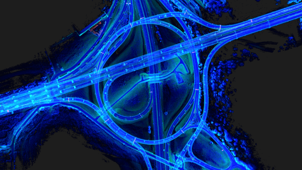
It felt like a waste to leave it unused on our hard drive, so we have made it available with the Creative Commons Attribution-Non-Commercial license. Under this license, the dataset is for researchers and students to test theories, do photogrammetry, 3D reconstructions, and more, as long as they stay within non-commercial use.

In 2024, we announced we would be launching the Prague REALMAP dataset and opened up preregistration to those interested in being the first to gain access to this valuable data. Pre-registration brought out faculty and students from well-known universities like Harvard, Brown, Stanford, UC Berkeley, NYU, the University of Toronto, and the Czech Technical University (CVUT).
Prague REALMAP in numbers
The images in the Prague REALMAP are precisely positioned, usually with around 2cm accuracy, and maintain an accuracy of 10-20cm, even in GPS-denied environments. This dataset includes:
- 210,469 panoramas in 13.5 K resolution
- 1,262,814 source images (6 x 12MP per panorama)
- 15.15 terapixels
- 1 image every meter along every track
- GDPR-compliant anonymization of faces and license plates

How to access the Prague REALMAP
If you’ve already registered for the Prague REALMAP dataset, click here to get started.
If you haven’t registered yet, complete this form to access the REALMAP and the Discord server. Then, head over to the Prague REALMAP and follow the download instructions. You need to have already filled out the registration form to access the dataset.
After you’ve digitally visited Prague, meet other innovators on the Discord server (the link is in the registration form) for discussion and collaboration opportunities. We hope to see you there!