In a world full ‘all-in-one’ solutions that lock clients into subscription plans and software vendors, Mosaic is a forerunner in returning data ownership to its clients.
Is a hands-off, all-in-one solution really a solution?
Full-scale service and data providers are increasingly common in the geospatial industry, especially in mobile mapping and surveying. They offer users an ‘easy’ way to receive the data that they desire for their asset inventory, inspection or management needs.
But this ‘easy solution’ means that clients have access to, but not ownership of, the data, nor choice in the data processing, hosting or software platform in which to analyze their 360° camera imagery and LiDAR. While these service models may seem convenient, they come with significant drawbacks for professionals in surveying, infrastructure management, and mobile mapping.
Sunk cost fallacy
One of the biggest concerns is cost accumulation over time. Unlike a one-time equipment purchase, many service providers only provide the data to their customers for a limited time, requiring ongoing payments in order for the user to access the data. This can quickly add up.
Surveyors and infrastructure teams often work on long-term projects that require continuous access to their mapping data. With a subscription model, they risk losing access to critical data if payments are missed or if the provider discontinues a service. This creates unnecessary financial uncertainty and dependence on a third party.
Owning the hardware ensures the users own the data and therefore controls it and reduces ongoing associated costs with renewing subscriptions.
Data control and restrictions
Another major issue is data control and ownership restrictions. Many subscription services store collected data on external cloud platforms, meaning users don’t fully own or control their datasets. This can lead to complications when integrating data into proprietary GIS workflows or using it for AI-driven analysis.
Data security risks
Infrastructure managers responsible for sensitive projects, such as highways, bridges, or rail networks, may also face security risks when storing data on third-party platforms, potentially exposing them to compliance and privacy issues.
Many countries, such as Saudi Arabia and South Korea, have data localization or data sovereignty laws that require personal data to be stored on physical servers located in the country of the data’s origins. Cloud servers with murky or foreign storage bases cannot be used to store the private information of citizens from such countries.
Proprietary file format
Why pay for features you won’t use? Or lock yourself into a software that isn’t tailor-made to your needs? Proprietary file formats force surveying professionals to use software they may not be familiar with, may be inefficient for a specific project, or requires another subscription payment to use.
You know your work processes best, so with Mosaic’s mobile mapping systems, your data will always be in a nonproprietary format for maximum efficiency. On this point, Michal Gula of 3Dise added,
Closed pipelines with automated processing make sense in situations, where your client is not a professional. In that case you are offering a foolproof solution, but with limited possibilities for new use cases.
Most professionals know, that there isn’t any “one tool fits all project” solution. So they know they need to combine different techniques with different workflows, from different providers, which is very difficult with closed environments.-Michal Gula, 3Dise
Lack of customizations
Additionally, subscription-based models often limit flexibility and customization. Surveyors and mapping professionals typically require specialized processing workflows tailored to their needs, but many SaaS-based platforms lock users into predefined software tools.
This can hinder efficiency and force professionals to adapt their workflows to the software rather than the other way around. For companies working on large-scale infrastructure projects, these limitations can create bottlenecks, slow down decision-making, and ultimately reduce operational efficiency.
Vendor lock-in
Lastly, subscriptions introduce long-term uncertainty and vendor lock-in. If a software provider changes pricing, discontinues a feature, or shuts down, professionals can find themselves scrambling for alternatives.
This is particularly problematic for surveyors and infrastructure teams that require long-term data retention for compliance and historical analysis. Having full ownership of hardware, software, and data ensures stability and prevents sudden disruptions from external vendors.
While subscription models may seem appealing for short-term projects, they often create more challenges than they solve for professionals who rely on consistent, long-term access to high-quality mapping data. Investing in outright ownership of hardware, software, and data storage provides greater financial predictability, security, and operational flexibility.
The Mosaic promise: you own your data – always
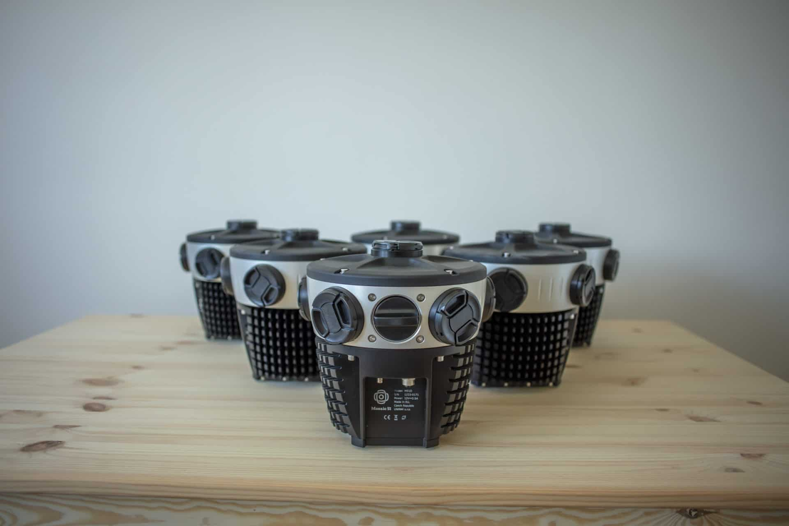
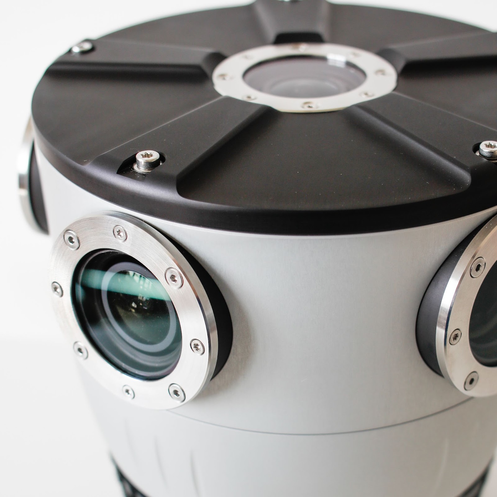
When you purchase a Mosaic mobile mapping camera system, you own the data you collect with our cameras forever. As the owner of the hardware, you can:
- Choose exactly what data you need,
- Choose when and where to collect data,
- Gather as much or as little data as is required for your specific project,
- Own the entire capture process, and
- Access historical data for as long as you want.
With a one-time payment for the hardware, there’s no need to hire third-party services. Just go out and start collecting data whenever you need it!
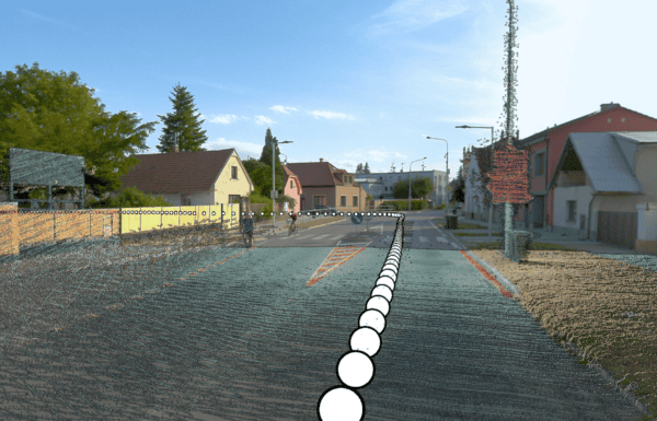
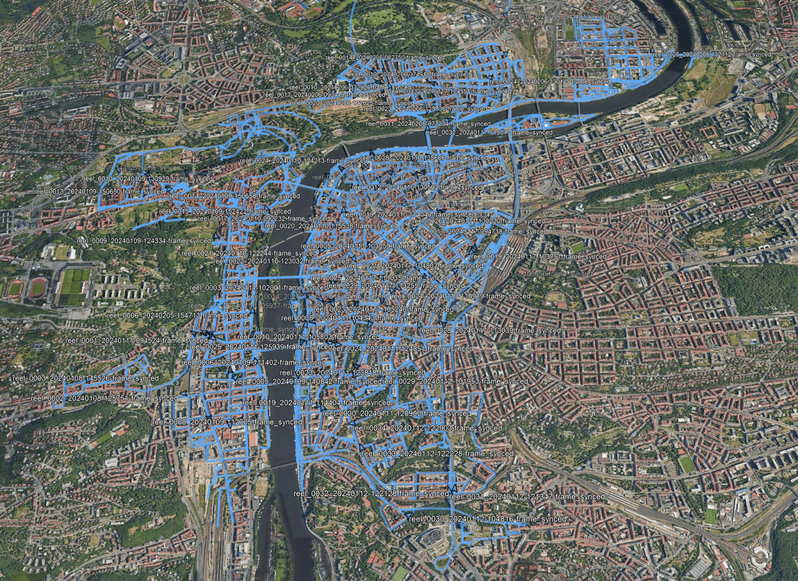
No more waiting for drone permits, aerial surveying companies, or data collection experts to fit you into their schedules, just hop in the car and start collecting data.
Mosaic’s data storage settings
All Mosaic cameras capture with user-accessible SSDs for data storage, so you have your hands on the data as soon as you’ve finished collecting it. The large capacity of the SSDs also ensures uninterrupted operation throughout the day, unlike smaller cameras that rely on micro SSDs with limited capacity.
The captured data is stored in a non-proprietary format, allowing seamless uploads to any software and enabling fully customized workflows. Our data is compatible with softwares such as Mapillary, 360Camsters, Prevu3d, Nodeology, and ESRI ArcGIS.
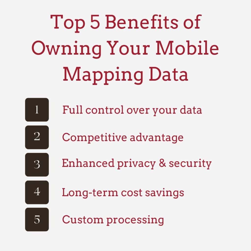
The top 5 benefits of owning your data
When purchasing a 360° mobile mapping camera system, owning the data you capture has several key benefits.
1. Full control over your data
When you own your data, you decide how, when, and where to use your collected data. This could be for internal analysis, reselling, or integration with other systems. There’s no third-party terms and conditions, restrictions, or licensing limitations to keep in mind.
This means:
- You can use the data for any internal project without additional licensing fees.
- You decide who gets access, whether it’s for internal teams, external clients, or partnerships.
- You have flexibility in updating, reprocessing, or integrating the data with new technologies as they emerge.
- There’s no risk of service disruptions due to policy changes from a third-party provider.
- For organizations that rely on geospatial data for decision-making, this control ensures maximum operational flexibility.
2. Competitive advantage & monetization
Exclusive access to your high-quality geospatial data can give your company a strategic edge. You can monetize your datasets by selling them to urban planners, infrastructure developers, or mapping platforms.
Exclusive access to high-resolution mapping data can provide a strategic edge, such as
- Offering proprietary datasets to clients rather than purchasing external ones.
- Generating up-to-date maps without relying on outdated or generic datasets.
- Collecting custom datasets tailored to their specific needs instead of using broad, publicly available data.
- Selling or licensing your data to third parties, creating an additional revenue stream.
3. Enhanced privacy & security
Keeping your mobile mapping data in-house minimizes your exposure to dangerous security breaches. These include unauthorized access by third parties and compliance risks associated with third-party cloud storage or data-sharing agreements. Fewer points of access mean fewer possible points of security failure.
The biggest advantage is compliance with data privacy laws. Avoid potential violations of GDPR in the EU, CCPA in California, and other regional regulations that may apply when using third-party services.
Storing your data in-house also minimizes risks compared to larger third-party cloud platforms that could be targeted by hackers. This is especially true for governments, defense contractors, and critical infrastructure firms working with sensitive geospatial data related to national security.
4. Long-term cost savings
This is particularly important for municipalities, transportation departments, and enterprises that rely on frequent and updated cadastral mapping. Avoid falling into the sunk cost fallacy of recurring fees for data access or third-party subscriptions. With Mosaic, your data, once collected, remains an asset that can be reused, updated, or repurposed without additional costs.
Purchasing raw data from external providers or subscribing to mapping services often comes with high recurring costs. With full data ownership,
- You eliminate your company’s dependency on third-party licensing fees.
- The data can be reused, repurposed, or resold as needed, maximizing return on investment.
- Updates to the data can be done at your discretion, rather than being forced into an external provider’s update cycle.
- If using AI-driven processing, the initial investment in data collection can continuously provide value without additional costs.
5. Custom processing & AI integration
Owning your hardware and data allows you to apply custom AI, machine learning models, or GIS workflows without restrictions. This flexibility enables advanced analytics, automation, and more tailored insights. It is incredibly helpful for
- Building proprietary GIS workflows tailored to specific business needs, rather than using generic third-party software with limitations.
- Developing automated object recognition algorithms for traffic signs, lane markings, vegetation encroachments, and more.
- Ensuring long-term compatibility with future AI/AR/VR applications without being restricted by external platforms.
- For companies investing in autonomous vehicle development, digital twins, or smart city planning, this ability to customize data processing is a game-changer.
Final thoughts on owning your data
Owning your 360° mobile mapping data empowers you with control, security, and long-term financial benefits. Whether you’re in surveying, urban planning, infrastructure management, or any industry relying on geospatial intelligence, having exclusive rights to your data is the key to financial and security success.
Want to learn more about Mosaic’s non-vendor-locked mobile mapping camera systems? Contact us today or browse our products!