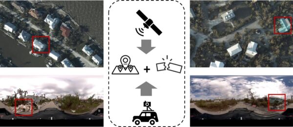
From field to office: streamlined data for faster decision making
In the rapidly evolving field of mobile mapping, a few well-established players have long dominated the market: RIEGL, Leica, and Trimble. These industry leaders offer high-end, feature-rich systems that excel in precision, workflow integration, and advanced LiDAR technology. However, not all users require the most expensive or densest point cloud systems for their projects. And so a new player entered the market – the Meridian Mobile Mapping System by Mosaic – offering a fresh approach. A solution that strikes a balance between usability, affordability, and the performance necessary for most real-world applications.
This article compares the Mosaic Meridian with its more expensive counterparts to highlight where each system shines and how the Meridian opens up new possibilities for mobile mapping without breaking the bank.
The MMS Industry Giants: RIEGL, Leica, and Trimble
Each of the established leaders in mobile mapping brings something distinct to the table, and for good reason. These companies have built their reputations by catering to specific, often demanding, applications.
1. RIEGL is renowned for its superior LiDAR systems. Their VMX-2HA system, capable of capturing up to two million points per second, is perfect for high-precision 3D modeling and virtual inspection. When absolute precision and dense point clouds are required, RIEGL is the go-to. However, the enormous datasets generated by RIEGL systems can often become more of a burden than a benefit, especially for users who do not need such extreme detail. Additionally, the post-process workflow requires an extremely skilled and experienced technician to complete the work, increasing costs.
(Mosaic X camera system users are already integrating the Mosaic X camera with several of RIEGL’s MSL. You can read more about those customers here and here.)
2. Leica has made its mark by offering user-friendly systems that streamline workflows and make complex data easy to manage. Their TRK series offers an accessible balance of LiDAR and imaging, making it popular in fields like urban planning and infrastructure inspection. However, Leica systems tend to be heavier and come with a higher price point, limiting their accessibility to teams that may not need their full range of capabilities.
3. Trimble is known for its end-to-end workflows that integrate fieldwork with office processing in a seamless manner. The MX9 system offers excellent accuracy (down to 5 mm/3 mm), making it ideal for detailed survey work.
However, for most use cases, many end users do not need this extremely high-density point cloud, but rather high-resolution imagery.
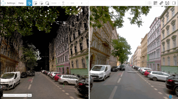
Information stored in point clouds could be much harder to share and describe quickly and easily when compared to high-resolution images. The average human looking at an image can tell more from that than from a point cloud, no matter the density.
Introducing the Mosaic Meridian: A Fresh Approach
Amidst these giants, the Mosaic Meridian offers a new perspective on mobile mapping. Unlike systems that focus on generating extremely dense datasets, the Mosaic Meridian prioritizes usability, cost-efficiency, and high-resolution imagery—three factors that make it more accessible to a wider range of professionals, from urban planners to asset managers.
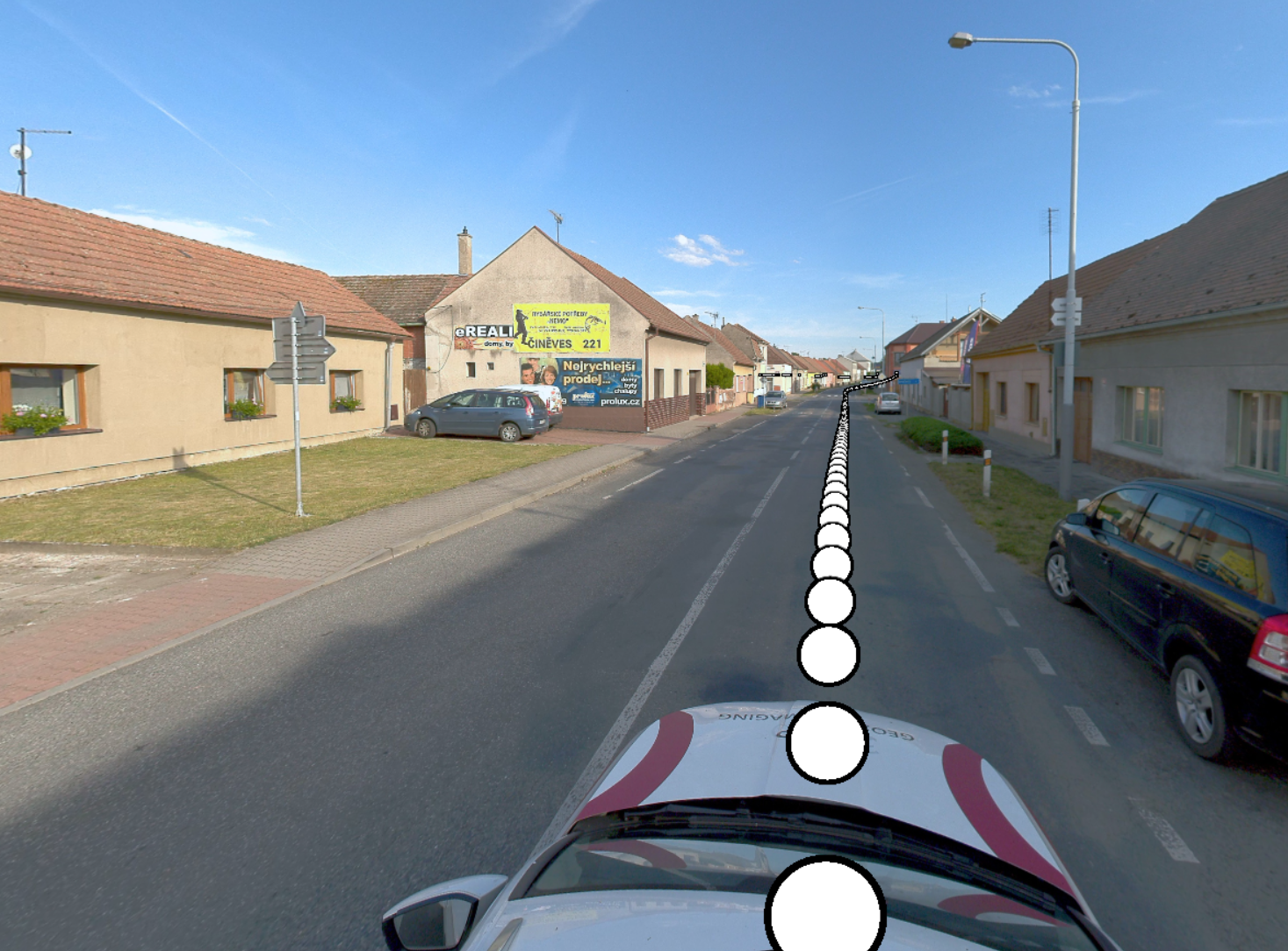
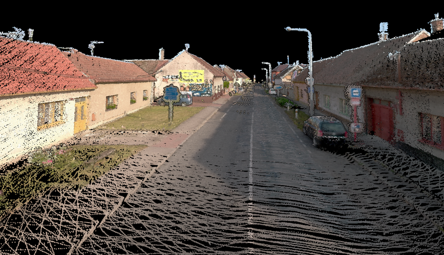
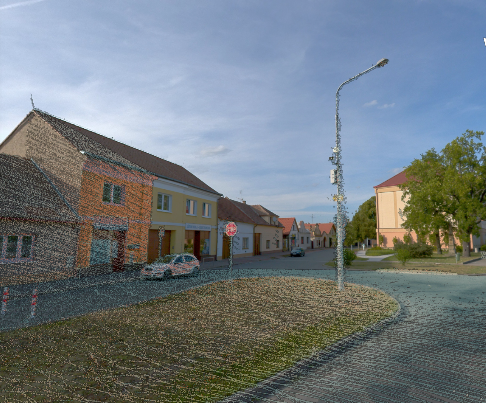
Explore how Mosaic Meridian captures high-resolution 360° imagery and LiDAR data for precise 3D models and colorized point clouds, offering an affordable, high-accuracy solution for GIS and surveying professionals.
Why Does This Matter?
Our goal is to collect just as many points that are processable for automatic feature extraction. We believe that medium dense point clouds and high resolution images can serve users better, because it could save time during data transfer, post process, and even during point cloud evaluation/feature extraction without compromising quality.
Ivan Hepp, Meridian Product Manager
1. User-Friendly Design
The Mosaic Meridian is designed for ease of use. With a 7 kg form factor, it’s significantly lighter than many of its competitors, such as Leica’s TRK500, which weighs 21 kg. This makes it easier to deploy in the field, especially for teams that don’t have the manpower or resources for heavy, complex equipment. Moreover, minimal training is required to operate the Meridian. Unlike Trimble’s systems, which often come with a steep learning curve, the Mosaic Meridian can be operated by nearly anyone, broadening its usability.
2. Budget-Friendly Solution
The Mosaic Meridian stands out by offering a streamlined solution that is accessible to a broader range of users, from large organizations to smaller firms and independent professionals who require high-quality data. By focusing on capturing the right amount of data—without excessive point cloud density—the system minimizes the time and resources required for data processing and storage. This efficiency reduces operational demands, making the Mosaic Meridian an ideal choice for teams looking to optimize their workflows without sacrificing quality.
3. Imagery-Centric Approach
The 91.2 MP camera at the heart of the Mosaic Meridian provides some of the highest-resolution imagery available in the mobile mapping world. While competitors like RIEGL focus on producing dense LiDAR point clouds, Mosaic places a greater emphasis on high-resolution imagery. This is crucial because imagery is more tangible and easier to interpret for a broader audience. In fields like infrastructure monitoring, urban planning, and asset management, users can easily understand imagery, whereas point clouds often require specialized tools to decipher. This imagery-centric approach allows teams to work more efficiently, reducing the need for extensive post-processing of LiDAR data.
Additionally, as AI models train on imagery and not on point clouds, AI image recognition is more advanced than point cloud recognition.
With the high-resolution 360º imagery from the Mosaic X, image recognition AI models, like the one from Simerse, can identify any pre learned assets. Moreover, because the Mosaic X also has an internal GNSS receiver, the AI can also locate the element, creating a fully automated GIS map about the assets of need.
Striking the Right Balance to Create Value Throughout
As will be discussed at Intergeo 2024, one of the biggest challenges in mobile mapping is striking the right balance between data density and usability. High-density point clouds, while impressive, can create significant inefficiencies during data acquisition, transfer, processing, and analysis. Systems like RIEGL VMX-2HA and Trimble MX9 are capable of capturing vast amounts of data—up to two million points per second—which is beneficial for detailed 3D modeling and highly specific applications. However, for many professionals, this level of detail is not only unnecessary but can also become a burden, leading to longer project timelines and higher operational costs.
Faster Data Acquisition
The Mosaic Meridian captures just enough data for most real-world applications without the excess. This means data collection in the field is significantly faster than with systems like the Trimble MX9, which often require more time to gather and store ultra-dense point clouds. By focusing on the essentials, the Meridian reduces the time it takes to scan large areas while still ensuring that the most critical information—such as infrastructure details or road conditions—is captured with precision.
Simpler Data Transfer and Storage
One of the most overlooked challenges with dense point clouds is the data transfer and storage burden they impose. High-density datasets not only require larger storage capacities, but they also take significantly longer to transfer from the field to the office, especially when using cloud-based services or limited internet bandwidth. This can slow down workflows and delay project timelines, particularly for organizations working in remote or bandwidth-limited environments.
In contrast, the Mosaic Meridian produces leaner datasets that are more manageable, reducing both storage requirements and transfer times. Whether you’re transferring data back to the office or uploading it to a cloud server, the smaller file sizes make it quicker and more efficient, freeing up bandwidth and reducing the need for high-capacity storage solutions. This advantage becomes even more crucial in industries like urban planning or infrastructure monitoring, where timeliness is critical to project success.
Quicker Post-Processing and Analysis
Discover how Mosaic Meridian’s 360 imagery and LiDAR sensors integrate with TopoDOT for efficient feature extraction, enabling precise, cost-effective urban planning and infrastructure management.
Once data is collected and transferred, it must be processed to generate actionable insights. For systems that produce extremely dense point clouds, post-processing can be a time-consuming and resource-intensive task, often requiring powerful hardware and specialized software to handle the massive datasets. AI models, used for tasks like feature extraction and classification, can become bogged down by excessive data, leading to slower analysis times and inefficiencies in the workflow. Or they can require an extra processing step to decimate the high-density point cloud.
The Mosaic Meridian addresses this by providing just the right amount of data for accurate analysis without overwhelming post-processing systems. This ensures that AI models can process data faster, leading to quicker insights and more timely decision-making. For applications like asset management or infrastructure inspection, this means that teams can move from data collection to actionable insights more quickly, ultimately speeding up the overall project timeline.
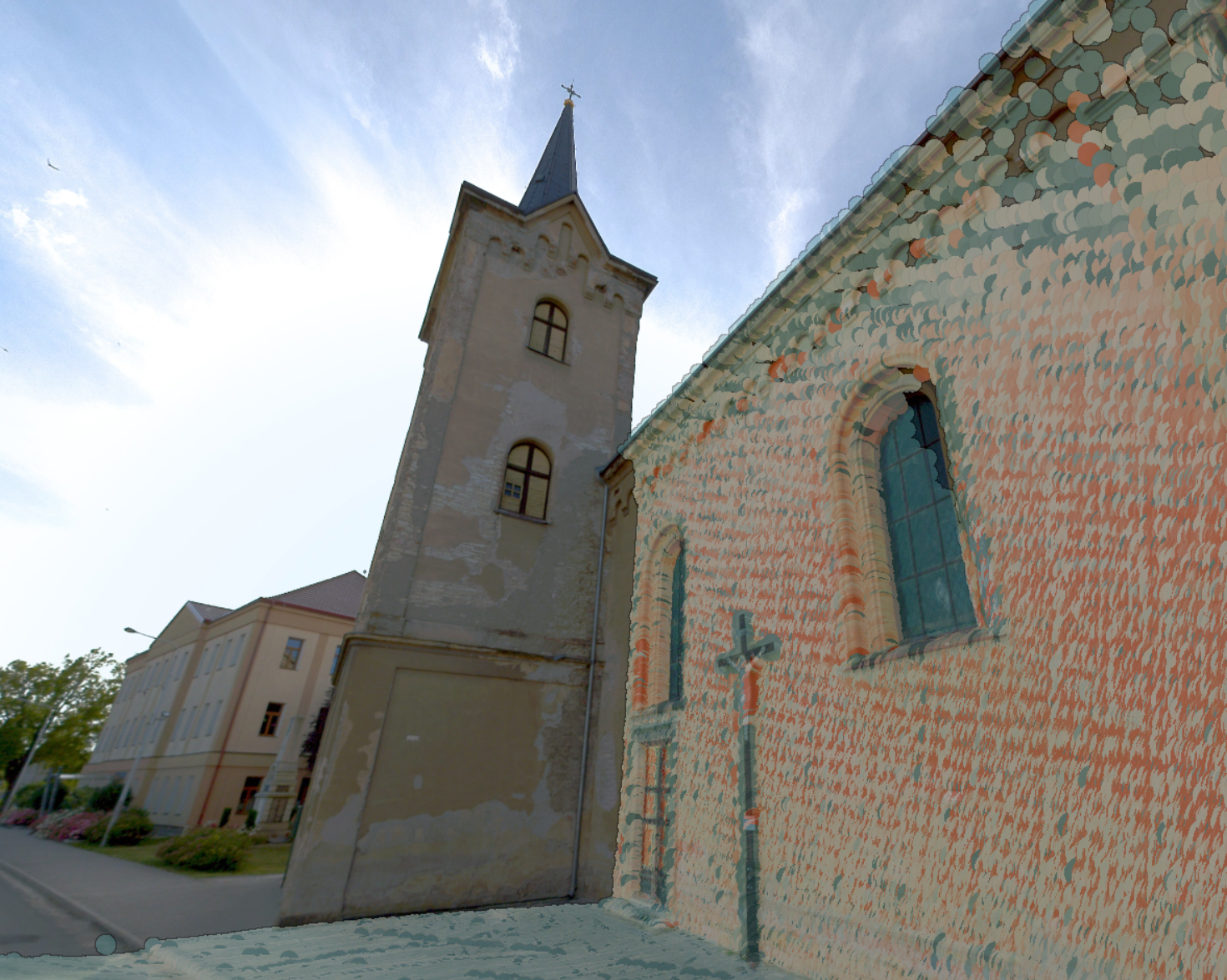
See how Mosaic Meridian’s high-res 360° imagery integrates with Pointly’s AI platform for precise point cloud classification, creating accurate asset databases using LiDAR data for entire cities.
By optimizing the amount of data collected, the Mosaic Meridian reduces the time and cost associated with post-processing, allowing for faster turnaround times on projects without sacrificing the quality of the results.
A Practical Solution for Most Applications
For most users in industries such as surveying, mapping, and GIS, systems like the RIEGL VMX-2HA or Trimble MX9—while excellent for high-end, niche applications—often provide more data than is necessary. The Mosaic Meridian offers a more practical solution by focusing on high-resolution imagery and optimized LiDAR that delivers the accuracy needed for effective project execution without the data overload that can slow down workflows. This balance ensures that professionals can move from data collection to insights with greater speed and efficiency.
The Mosaic Meridian has already proven to be a valuable tool in several key industries.
Urban Planning: Its high-resolution imagery allows for precise, visual records of landscapes and infrastructure, enabling faster decision-making.
Infrastructure Monitoring: Rather than being bogged down by dense point clouds, users can focus on the most important features, such as road conditions or asset health.
Asset Management: By offering clear, understandable imagery, the Meridian enables easier inspections and maintenance planning.
In essence, the Meridian not only simplifies workflows but also enhances the quality of the insights drawn from collected data.
.
Conclusion: A New Era in Mobile Mapping
The Mosaic Meridian isn’t here to replace systems like RIEGL, Leica, or Trimble; instead, it provides an alternative for professionals who need efficient, affordable, and user-friendly solutions. Its focus on imagery and precision makes it a perfect tool for those who want high-quality results without being burdened by excessive costs or complicated workflows.
In a market full of powerful, dense-data systems, the Mosaic Meridian offers a fresh take—balancing the need for high-quality mapping with the practical demands of usability and affordability. If you’re looking for a solution that provides everything you need without overwhelming you with unnecessary data, the Mosaic Meridian could be the tool you’ve been waiting for.
Competitive Matrix for Mosaic Meridian
| Feature | Mosaic Meridian | RIEGL VMX-2HA | Leica Pegasus Ul. | Trimble MX9 |
| Data Density | 500k points/sec | ≤ 2M points/sec | ≤ 2M points/sec | ~1.2M point/sec |
| Setup Time | ~ 15 min | ~ 1 hour | ~ 1 hour | ~ 30 min |
| Operational UI | Any mobile device Web based | Laptop Variable settings options | Laptop | Tablet or laptop Web-based |
| Ease of use | Easy | Complex | Mid-range | Mid-range |
| Portability | Lightweight and easy to install < 15kg | Heavy, complex system > 60kg | Heavy system, limited portability ~ 50kg | Portable ~ 40kg |
| Image Resolution | 91.2 MP | 24 MP | 48 MP | 72 MP |
| Post processing 8-10h survey | 8 hours | 12-15 hours | 10 – 14 hours | 10 hours |
| Price | $ | $$$ | $$$ | $$ |
FAQs
What industries benefit the most from the Mosaic Meridian?
Industries such as construction, infrastructure management, urban planning, and real estate development greatly benefit from the Meridian’s capabilities. Its ability to capture high-resolution imagery and synchronized LiDAR data makes it an ideal tool for precise mapping and inspection tasks.
How does the Mosaic Meridian compare to competitors in terms of pricing?
The Mosaic Meridian offers a competitive advantage in pricing, coming in at a fraction of the cost of many of the major players, while many competing systems from brands like Leica and Trimble can cost in the hundreds of thousands of euros/dollars more.
Is the Meridian easy to operate for those without technical expertise?
Yes, one of the key advantages of the Meridian is its user-friendly design. It requires minimal training, making it accessible even to those with limited experience in mobile mapping.
What is the image quality of the Mosaic Meridian compared to competitors?
The Mosaic Meridian features a 91.2 MP camera, delivering some of the highest image resolution available in mobile mapping today, outperforming many competitors such as Trimble and Leica.
Why focus on imagery over dense point clouds?
Imagery is more tangible and easier for most people to interpret, whereas point clouds often require specialized tools. This makes the Mosaic Meridian ideal for projects where clear, visual data is more valuable than overly detailed point clouds
Are YOU looking for a solution that meets all of your needs in terms of data quality, ease of use, and budget?
Then contact our team today.