Latest post

Case Study: Midwest Energy & Communications’ Innovative Approach to Utility Mapping with the Mosaic X Camera 

Read how Midwest Energy & Communications harnessed their Mosaic X camera for superior data capture, resulting in streamlined operations, improved safety, and high-quality infrastructure mapping, driving forward their utility services.

Mosaic Insights

Explore the world of 360-degree mobile mapping and surveying, 360-degree cameras, and the limitless possibilities of the 360 world.
Check out what’s new with Mosaic, new emerging trends in our industry, and how pushing back boundaries is impacting our world.
mapillary plugin for arcgis shows 360 imagery side by side your gis data
Community

Integrating 360 Street View Imagery in ArcGIS: Enhancing Geospatial Visualizations with Mapillary

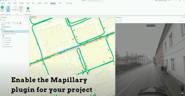
Unlock the full potential of ArcGIS with our guide on integrating Mapillary and Mosaic 360 cameras for dynamic street view imagery. Discover how to enrich your geospatial projects with up-to-date, panoramic visuals, and learn about the benefits of collecting your own data. Perfect for ArcGIS Pro and Web App Builder users seeking to leverage street-level imagery for insightful analysis and compelling map visualizations.

Read More »