15 TERAPIXELS of Stunning Prague Imagery for Your Research Needs
By CEO of Mosaic, Jeffrey Martin
April 2025 update: The Mosaic REALMAP is here! Check out our latest article for the full details.
(FOR THE FREE DATA SET, GO TO THE BOTTOM, CLICK THE LINK AND FILL OUT THE FORM)
I am thrilled to announce the release of an incredibly high-quality image dataset of Prague, available for non-commercial use under the Creative Commons Attribution-NonCommercial 4.0 International (CC BY-NC 4.0) license. This project represents a significant milestone in the fields of computer vision, data processing, and 3D modeling research, and I hope it will be a valuable resource for many.
In numbers, this dataset is:
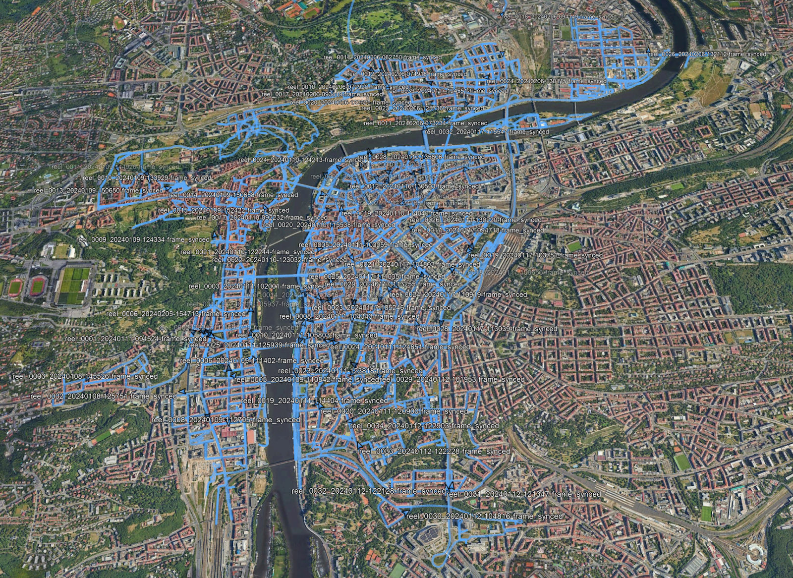
- 210,469 panoramas in 13.5 K resolution
- 1,262,814 source images (6 x 12MP per panorama)
- 15.15 terapixels
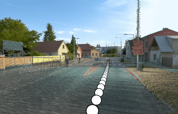
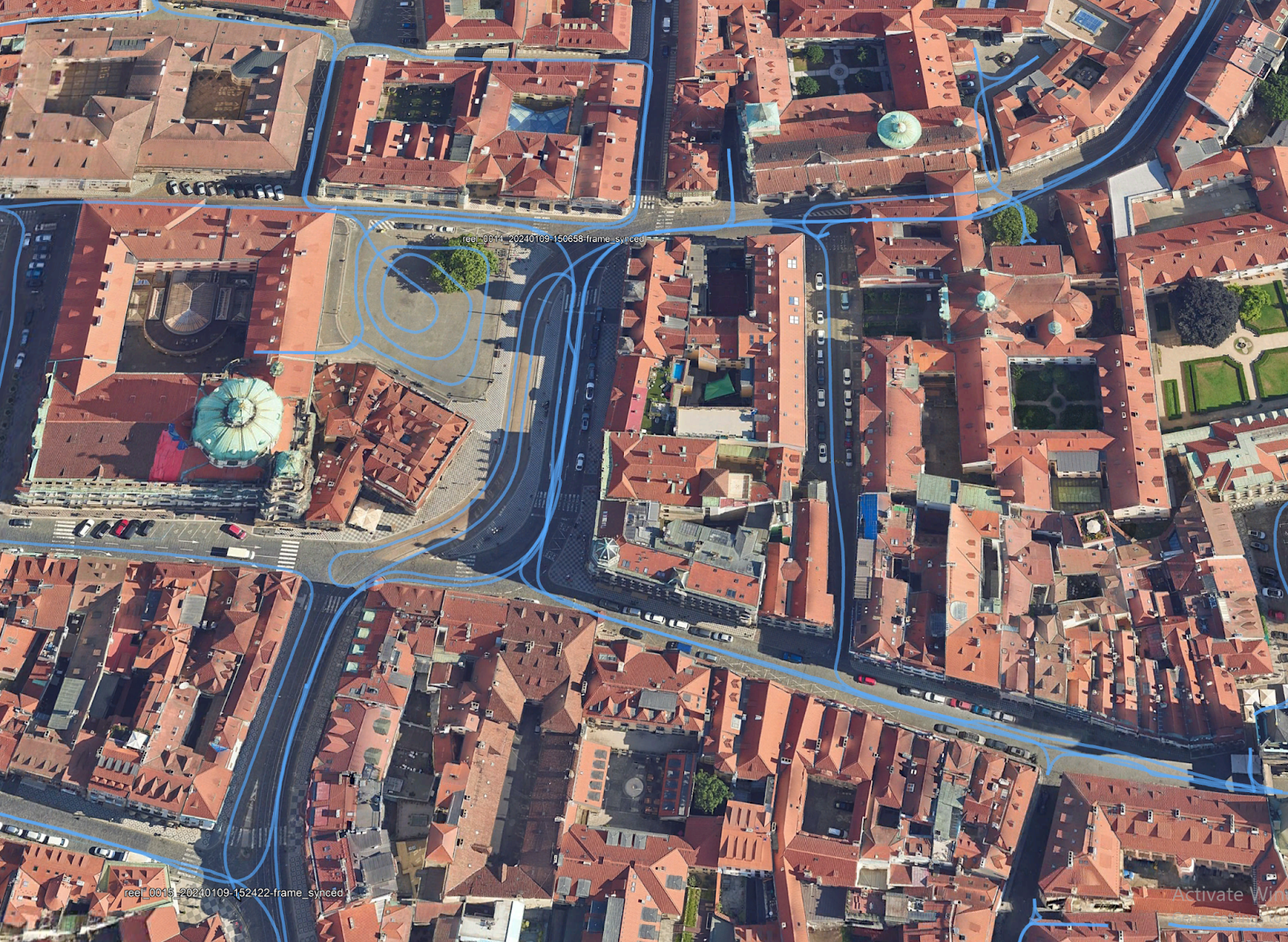
- 1 image every meter along every track
The images are precisely positioned, usually with around 2cm accuracy, and maintaining an accuracy of 10-20cm, even in GPS-denied environments.
You can find a KMZ file showing the location of this dataset here (2.2MB)
We are providing intrinsic and extrinsic calibration data for the camera as well.
My Journey in 360-Degree Imaging
My journey in 360-degree imaging began back in 2005 when I launched prague360.com. It was one of the first websites to combine georeferenced 360-degree images on a map. This project eventually grew into 360cities.net, the world’s longest-running platform for high-resolution, georeferenced 360-degree photography.
Over the years, I’ve had the opportunity to push the boundaries of gigapixel photography. In 2009, I published an 18-gigapixel image of Prague, and in 2014, a 320-gigapixel image of London, which earned a spot in the Guinness Book of World Records and was featured on BBC shows. These projects were not just technical challenges but also artistic endeavors, aiming to capture the beauty and complexity of urban landscapes in unprecedented detail.
In 2015, I founded Sphericam, a company focused on VR and 360-degree video cameras. Despite facing many challenges, Sphericam evolved into Mosaic in 2018, a company I am proud to lead today. The journey from Sphericam to Mosaic was fraught with obstacles, but it taught me invaluable lessons about resilience, innovation, and the importance of adapting to changing technologies and market needs.
In the second part of our interview with Nick Reese, we discuss the origins of my first 360° camera and the creation of the Mosaic 51. I’m excited to share the lessons we’ve learned. You can find all three parts of the interview on our YouTube channel.
The Mission of Mosaic
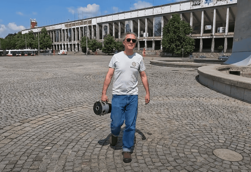
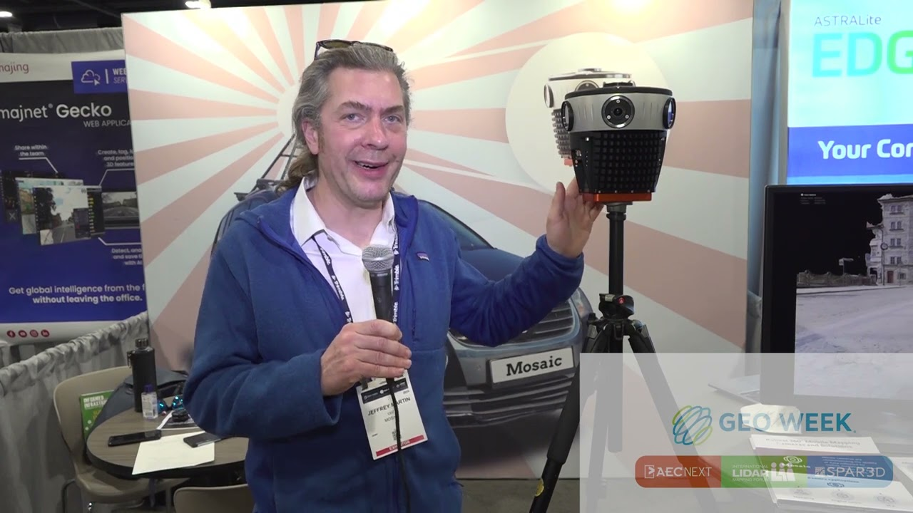
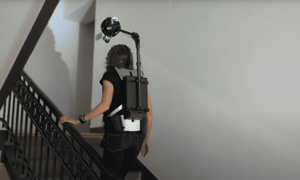
At Mosaic, we build hardware and software for 360-degree imaging. Our cameras are used in over 40 countries worldwide, and we have managed to outclass our competitors in the GIS industry despite being a small team. Our latest product, the Xplor, is a backpack camera designed for creating 3D Gaussian Splats and photogrammetric models while walking, climbing, or riding a bicycle, scooter, or motorcycle.
Mosaic’s mission is to democratize high-quality 360-degree imaging and make it accessible for various applications, from street mapping to large-scale photogrammetry. We believe that by providing the best tools and technologies, we can enable researchers, developers, and enthusiasts to push the boundaries of what’s possible in imaging and visualization.
The Prague Dataset: A Labor of Love
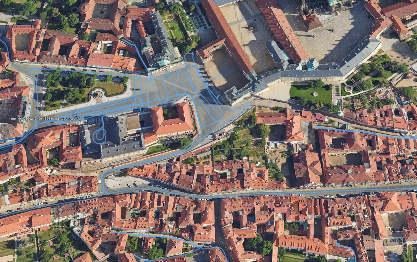
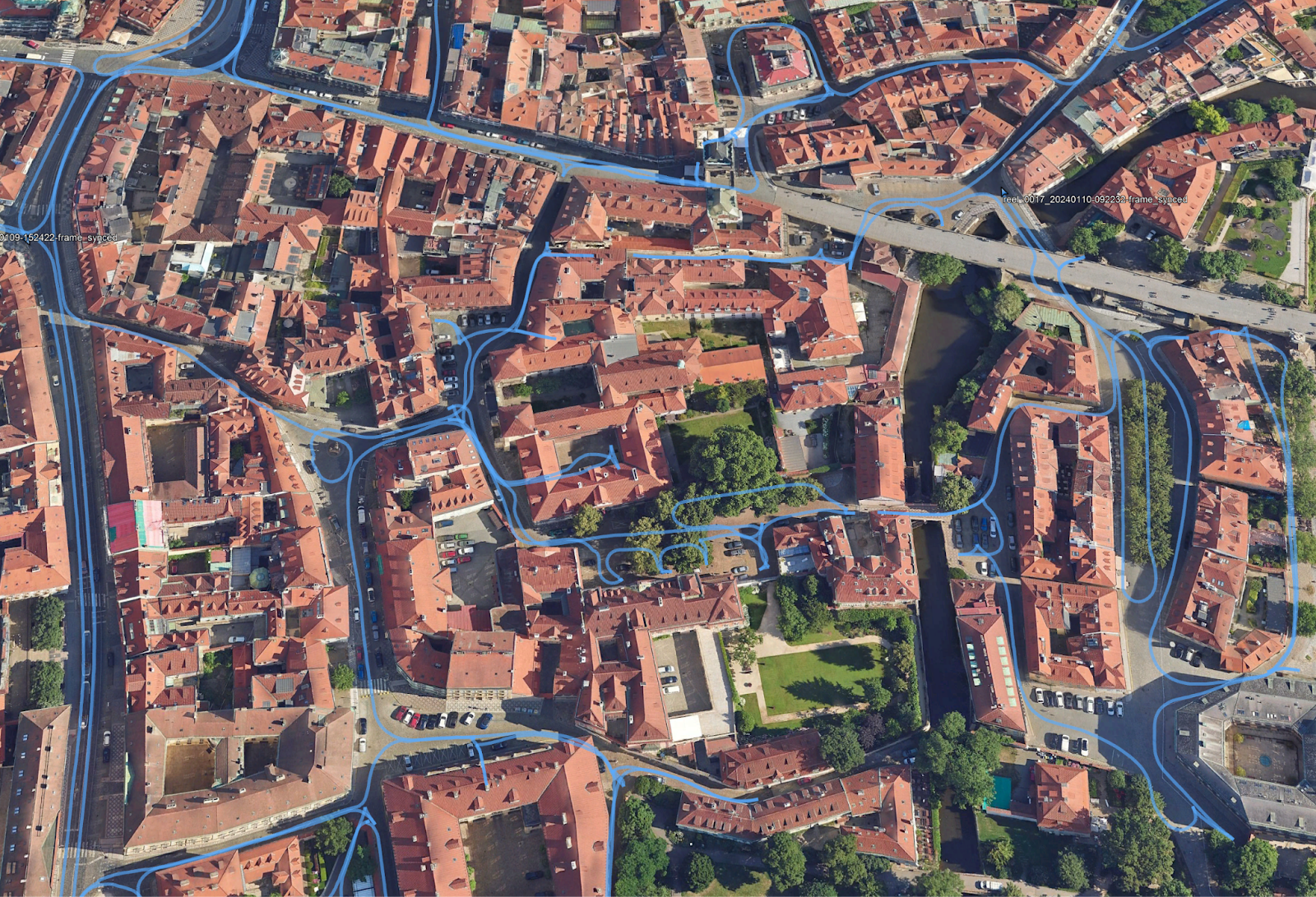
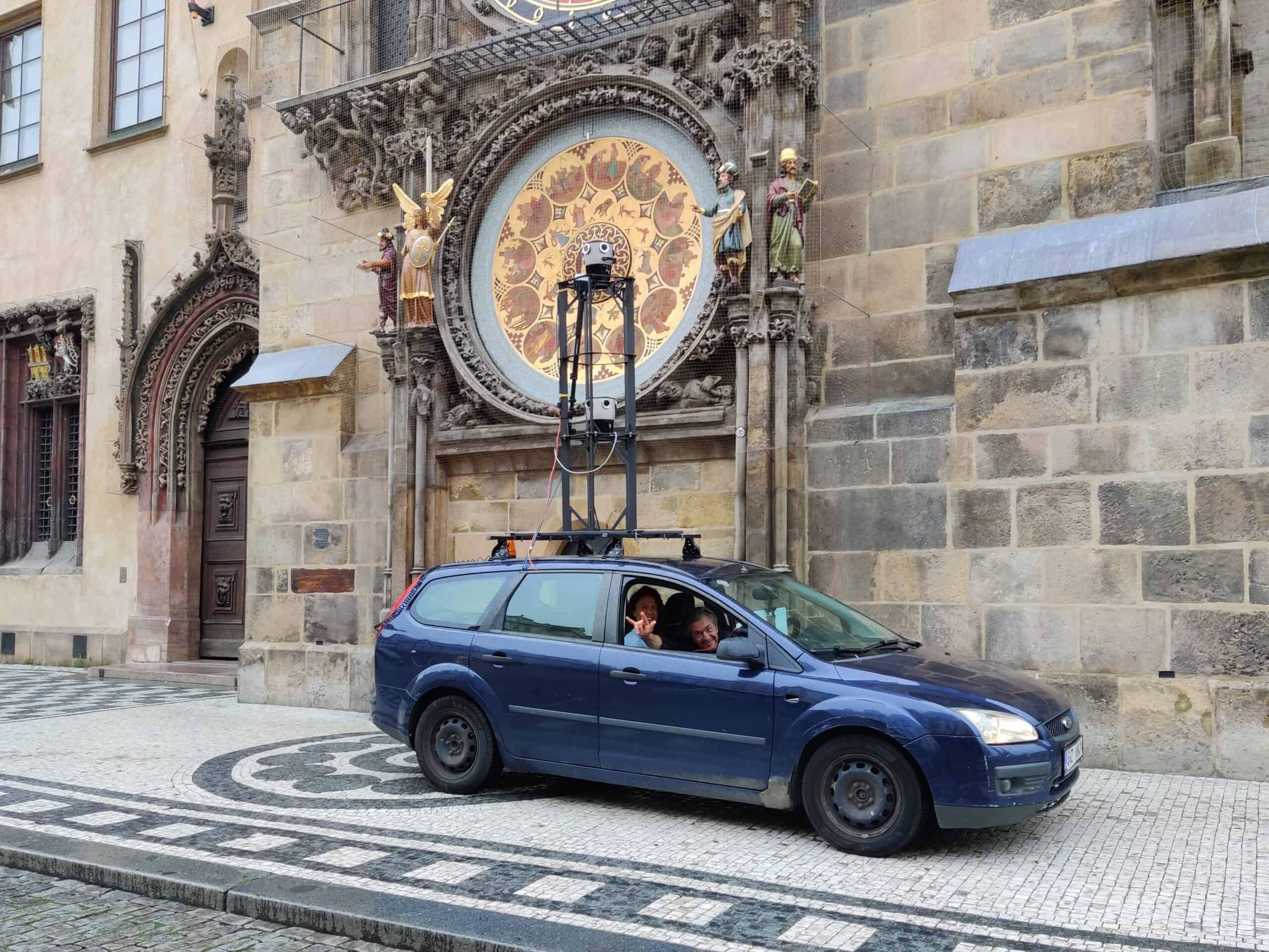
I am particularly excited about our new Prague dataset. This isn’t just any dataset; it’s a collection of images from one of the most beautiful cities in the world. Nearly all of the city center is covered, and the images were captured on a cloudy day to avoid harsh shadows, ensuring optimal lighting conditions.
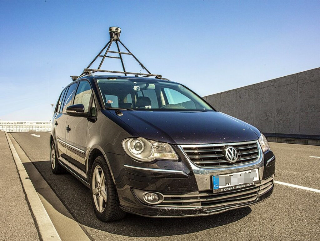
We used the Mosaic X camera, which features 72 megapixels from a global shutter, ensuring that there is no motion blur. The images were captured at a low speed, with one image taken every meter. The precision and quality of this dataset are unmatched, with most of the data being centimeter-accurate.
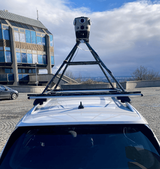
The dataset is composed of 210,469 panoramas and 1,262,814 images, totaling an astounding 15.15 terapixels (1.5153768e+13 pixels). This massive collection offers a comprehensive visual representation of Prague’s architecture, streetscapes, and urban environment in incredible detail. From the historic charm of Old Town to the vibrant energy of modern neighborhoods, this dataset captures the essence of Prague.
Use Cases for this Dataset in Research
Computer Vision Research
The Prague dataset offers an unprecedented opportunity for advancements in computer vision research. With 1.26 million high-resolution images meticulously captured at one-meter intervals, researchers can explore a wide array of applications, from object recognition and image segmentation to scene understanding and visual navigation. The high-quality and dense data enable the development and testing of more accurate and robust computer vision algorithms, pushing the boundaries of what machines can perceive and interpret.
Photogrammetry Research
In the realm of photogrammetry, the Prague dataset provides an invaluable resource for creating detailed 3D models. The centimeter-accurate positioning and high-resolution images facilitate the precise reconstruction of urban environments, which can be used for various applications such as historic preservation, urban planning, and architectural analysis.
Point Clouds
Generating point clouds from the Prague dataset allows researchers to create highly detailed 3D representations of the cityscape. These point clouds are essential for various analyses, including structural integrity assessments, urban planning, and virtual reality applications. The dataset’s high resolution and accuracy make it ideal for generating precise and reliable point clouds.
3D Gaussian Splatting
The dataset supports 3D Gaussian splatting, a technique used to create smooth and continuous surface representations from point cloud data. Researchers can utilize the high-quality images to develop and refine algorithms that produce more accurate and visually appealing 3D models, enhancing applications in virtual reality, gaming, and simulation.
Neural Radiance Fields (NeRFs)
NeRFs are a cutting-edge technique for synthesizing novel views of complex 3D scenes. The Prague dataset, with its extensive and detailed imagery, provides an excellent foundation for training NeRF models. This can lead to breakthroughs in generating photorealistic renderings and understanding complex environments in applications such as augmented reality and autonomous navigation.
Object Detection and Recognition
The diverse and dense imagery in the Prague dataset is perfect for advancing object detection and recognition technologies. Researchers can develop and validate algorithms that identify and classify various objects within urban environments, improving systems for surveillance, traffic management, and smart city applications.
Tree and Vegetation Analysis
Environmental researchers can leverage the dataset to analyze urban greenery. The high-resolution images enable detailed studies of tree health, species identification, and vegetation coverage. This can aid in urban ecology research, conservation efforts, and the management of green spaces within cities.
Road Surface Monitoring
The Prague dataset is an excellent resource for road surface monitoring. Researchers can use the high-quality images to detect and analyze road conditions, identifying issues such as potholes, cracks, and wear. This information is crucial for maintaining road safety and planning maintenance activities efficiently.
Power Line Inspection
The precise and detailed imagery in the dataset can be used for power line inspection. By analyzing the images, researchers can develop methods to detect faults, monitor the condition of power lines, and ensure their integrity. This application is vital for preventing outages and ensuring the reliable delivery of electricity.
Fostering Innovation and Collaboration
By releasing this dataset under the CC BY-NC 4.0 license, we aim to support the evolution of image processing, computer graphics, photogrammetry, NeRFs, and 3DGS. We believe that having access to high-quality data is crucial for testing and validation in these fields.
We are also eager to receive feedback on how this data works for different tasks and applications. Your insights will help us continue to evolve our hardware and software. By understanding the diverse needs and challenges faced by researchers and developers, we can improve our products and create even more powerful tools for the future.
Of course, we are not completely selfless in this endeavor. We hope to get our name out there and raise awareness of our work. We are a small, scrappy team, and the more we share, the more we can grow. Life isn’t a zero-sum game, after all. We believe in the power of collaboration and the idea that by working together, we can achieve greater things than we ever could alone.
We also recognize the importance of contributing to the global research community. By providing this dataset for non-commercial use, we hope to facilitate groundbreaking research and discoveries that can benefit society as a whole. From improving urban planning to advancing autonomous vehicle technologies, the potential applications of this dataset are vast and varied.
Looking Ahead
We have only just begun our journey in building the world’s best cameras for mapping and scanning the world. I am excited about what the future holds and can’t wait to share our upcoming projects with you.
Our vision for the future includes developing even more advanced imaging technologies and expanding our reach to new markets and applications. We are constantly exploring new ways to enhance the capabilities of our cameras and software, driven by the feedback and needs of our users.
In the coming months, we plan to release additional datasets from other iconic locations around the world. Each dataset will be carefully curated and captured with the same attention to detail and quality that we have applied to the Prague dataset. We are committed to pushing the boundaries of what’s possible in 360-degree imaging and making these resources available to the global community.
Thank you for your support, and I hope this dataset will be as valuable to you as it is to us. Together, let’s explore new frontiers in imaging and visualization, and unlock the full potential of this amazing technology.
For any inquiries or further information, please fill out this form here:
Sincerely,
Jeffrey Martin